Rapid global urbanisation has highlighted the importance of understanding changing interactions between humans and the environment.
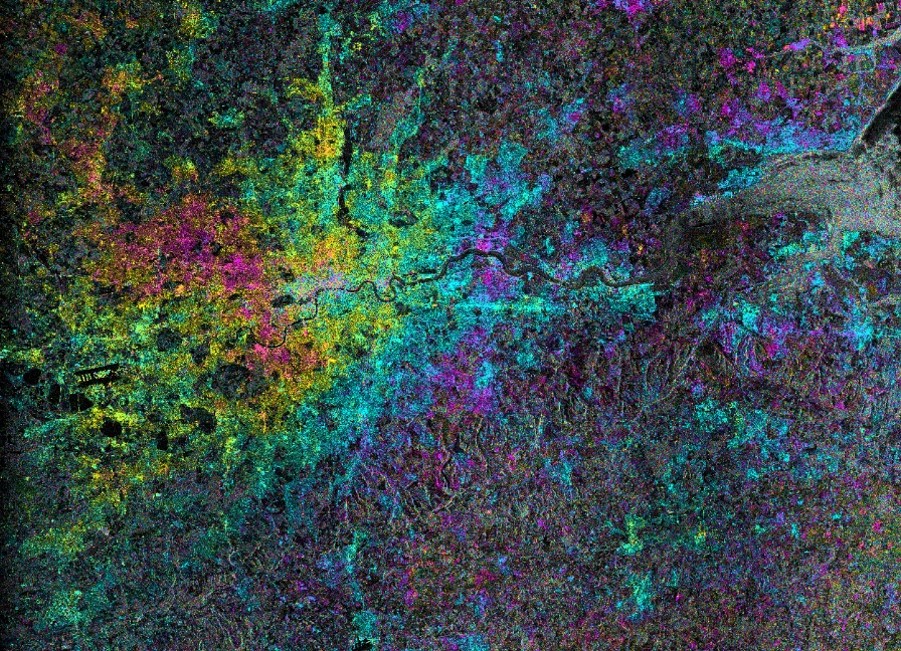
Earth observation data can monitor how human activities impact nature, support the development of resilient cities and track the effects of historical human impact. Advances in machine learning and artificial intelligence can extract insights from optical images collected from satellites and UAVs. Interferometric Synthetic Aperture Radar (InSAR) can be used to monitor millimetre-scale movements to track changes on a city scale as well as identify signs of unusual structural behaviour. Population and urban growth can be tracked using earth observation and geo-data.
The key value, however, is in bringing together a multidisciplinary approach to understand how sustainable development can be achieved – to balance modern human activities and lifestyle with the challenges facing the urban environment. Integration of earth observation data with other datasets collected on the ground might enhance the details of dynamic phenomena further enhanced by improving spatial, spectral and temporal resolutions of earth observation data.
Selected Publications
Combined InSAR and Terrestrial Structural Monitoring of Bridges
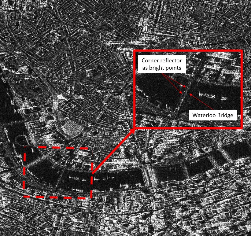
This paper examines advances in interferometric synthetic aperture radar (InSAR) satellite measurement technologies to understand their relevance, utilization, and limitations for bridge monitoring. Waterloo Bridge is presented as a case study to explore how InSAR data sets can be combined with traditional measurement techniques including sensors installed on the bridge and automated total stations. A novel approach to InSAR bridge monitoring was adopted by the installation of physical reflectors at key points of structural interest on the bridge, in order to supplement the bridge’s own reflection characteristics and ensure that the InSAR measurements could be directly compared and combined with in situ measurements. Selvakumaran (2020) IEEE Transactions on Geoscience and Remote Sensing
A brave new world for archaeological survey: Automated machine learning-based potsherd detection using high-resolution drone imagery
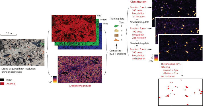
This paper presents the first proof of concept for the automated recording of material culture dispersion across large areas using high resolution drone imagery, photogrammetry and a combination of machine learning and geospatial analysis that can be run using the Google Earth Engine geospatial cloud computing platform. The results show the potential of this technique, under appropriate field circumstances, to produce accurate distribution maps of individual potsherds opening a new horizon for the application of archaeological survey. The paper also discusses current limitations and future developments of this method. Garcia-Molsosa (2019) Journal of Archaeological Science
Remote monitoring to predict bridge scour failure using Interferometric Synthetic Aperture Radar (InSAR) stacking techniques
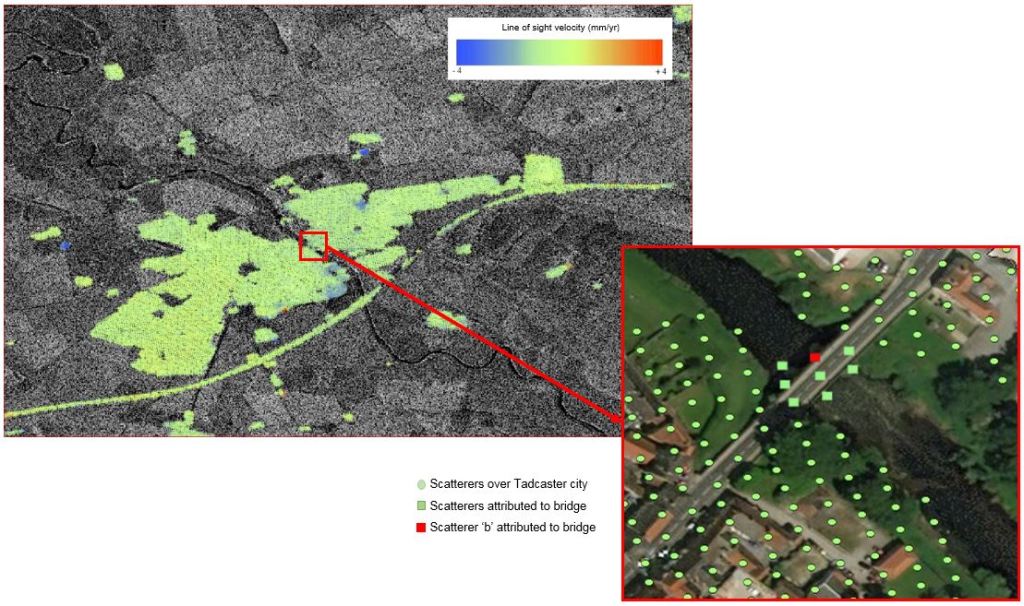
TScour is the removal of ground material in water bodies due to environmental changes in water flow. It particularly occurs at bridge piers and the holes formed can make bridges susceptible to collapse. Failure of bridges due to scour is currently very difficult to predict since conventional assessment methods foresee very resource-demanding monitoring efforts in-situ. This paper presents evidence of how InSAR techniques can be used to monitor bridges at risk of scour, using Tadcaster Bridge, England, as a case study. A precursor to failure observed in the data over a month before actual collapse suggests the possible use of InSAR as a means of an early warning system in structural health monitoring of bridges at risk of scour. Selvakumaran (2018) International Journal of Applied Earth Observation and Geoinformation
