The cryosphere, which encompasses all portions of the Earth’s surface where water is found in solid form, is one of the most dynamic components of the Earth’s climate system.
It includes glaciers, ice caps and ice sheets, as well as sea ice, lake/river ice, snow cover, seasonally frozen ground and permafrost; and hence, it is extremely sensitive to rising air temperatures, such as those predicted for the near future.
Research into the cryosphere occurs across Cambridge, including the Scott Polar Research Institute, Department of Earth Sciences, and the British Antarctic Survey. Earth observation techniques
Selected Publications

Lateral meltwater transfer across an Antarctic ice shelf
We develop a semi-automated algorithm capable of tracking surface water bodies on Antarctic ice shelves, using a combination of Landsat 8 and Sentinel-2 imagery. In this paper, we apply our method to the Nivlisen Ice Shelf in the 2016-2017 melt season, and track changes in the geometry, area and volume of 1598 water bodies. We identify the greatest volume of surface melt ( 5.5×10⁷ m3) on the 26th January 2017. On this day, 63 % of the total volume is held in two linear water bodies, which extend up to 27 km across the ice shelf surface. Dell (2020) The Cryosphere
Supraglacial lake drainage at a fast-flowing Greenlandic outlet glacier
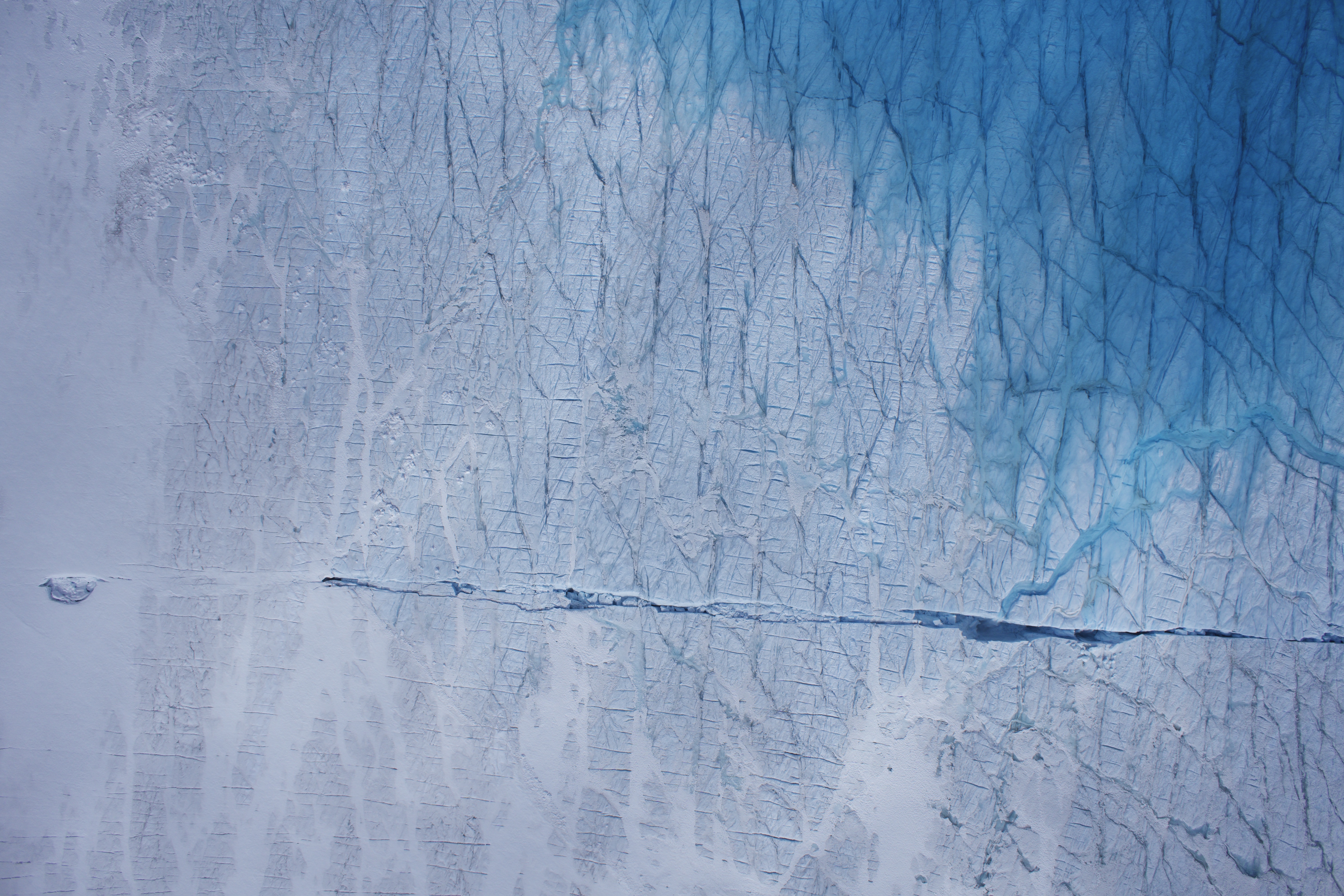
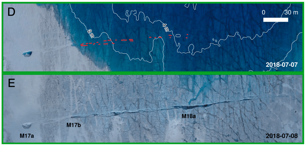
We present combined UAV and in situ records of a rapidly draining supraglacial lake in a fast-flowing sector of the Greenland Ice Sheet. Despite supraglacial lake drainage influencing ice sheet dynamics at a variety of scales, existing in situ studies have been conducted exclusively at the slower, less dynamic land-terminating sector. We describe the scale and extent of dynamic response in a marine-terminating system, and identify 1) spatially distributed behavior not previously observed in in situ studies, and 2) interannual variation unique to fast-flowing glaciers. We propose that many lakes thought to drain slowly are, in fact, draining rapidly via hydrofracture. As such, rapid drainage events, and their net impact on ice sheet dynamics, are being notably underestimated. Chudley (2019) PNAS.

High-accuracy UAV photogrammetry of ice sheet dynamics with no ground control
Unmanned Aerial Vehicles (UAVs) are increasingly common tools in the geosciences, but their use requires good ground control in order to make accurate georeferenced models. This is difficult in applications such as glaciology, where access to study sites can be hazardous. We show that a new technique utilising on-board GPS post-processing can match and even improve on ground-control-based methods, and, as a result, can produce accurate glacier velocity fields even on an inland ice sheet. Chudley (2019) The Cryosphere
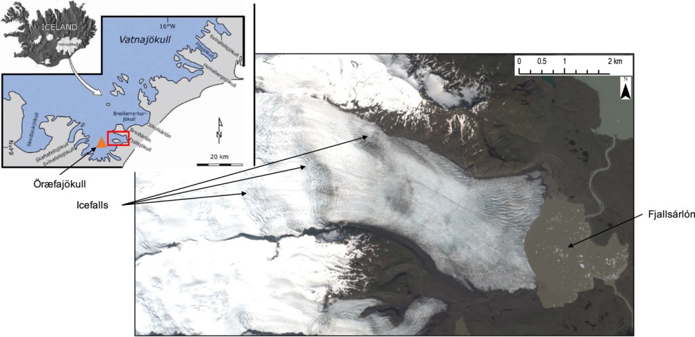
Response of glacier flow and structure to proglacial lake development and climate at Fjallsjökull, south-east Iceland
Remote sensing can be used to gather detailed information on changes to a glaciers flow regime, structural architecture, frontal position, and terminal environment . This paper applies methods including structural mapping and feature tracking to Fjallsjökull, an outlet glacier in south-east Iceland. Dell (2019) Journal of Glaciology
