Presentation by Professor Peng Gong from Tsinghua University at 12.00 Thursday 5th December, Tom Ap Rees Lecture Theatre, Department of Plant Sciences
Abstract
In this presentation, I will report our global land cover mapping efforts beginning in 2010. Initially, a classification system was developed for the purpose of climate modeling needs. A sampling software was developed to enable efficient sample collection over the world. With this sample set, we experimented to map the world for 2010, 2015, 2017 using Landsat images. In 2018, we tested the transferring of 30 meter resolution sample to 10 meter resolution global land cover mapping using Sentinel data. We find sample collected in a specific year at a certain resolution can be transferable to other years thanks to the robustness of classifiers and large-size and representativeness of the sample. We also made efforts to map specific land cover classes such as impervious areas, croplands, and water at the global scale. Different from general land cover mapping, mapping specific themes has led to more timely-frequent global data sets that enriched the application of global land cover much beyond our original objective.
Looking into the future we are forming a Global Mapping and Application Partnership (GMAP) with collaborators from USGS, Google, Amazon and Shangtang. In this presentation I shall disclose some of our initial collaborative results through GMAP.
Short Bio
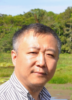
Peng Gong is Professor and Chair of the Department of Earth System Science, Dean of School of Sciences at Tsinghua University (Beijing, China). He studied at Nanjing University (1980-1986), the University of British Columbia (1986-1987), the University of Waterloo (1987-1990), and taught in the Department of Geomatics Engineering at the University of Calgary (Canada) between 1991 and 1994, and had been on faculty in the Department of Environmental Science, Policy and Management at the University of California, Berkeley (USA) between 1994 and 2015.
He served as the founding Director of the International Institute for Earth System Science at Nanjing University (China), and the founding Director of the State Key Laboratory of Remote Sensing Science, jointly sponsored by the Institute of Remote Sensing Applications of the Chinese Academy of Sciences and Beijing Normal University (2004-2010). His major research interests include mapping and monitoring of global environmental change using satellite and ground based sensors, and modelling of environmentally related infectious diseases.
He published over 500 papers, books and reports, and presented over 200 talks in 33 countries. He pioneered monitoring and modeling of urbanization, hyperspectral remote sensing of vegetation, application of wireless sensor network in environmental monitoring and completed the first 30-m and 10-m resolution global land cover map in the world. He also developed and applied regional and global analysis technologies in the modeling of the spatial-temporal transmission of such infectious diseases as schistosomiasis, avian influenza, dengue, malaria, plague and hanta virus.
